


Leyte
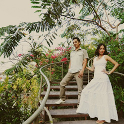
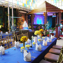
Wedding Destination
Leyte – Land of History
It was on the shores of Leyte that General Douglas MacArthur fulfilled his promise to the Filipino people of returning to the Philippines and helping the Filipino forces liberate the country. This happened on October 20, 1944. With this, Leyte became one of the most historically-rich provinces of the Philippines. From battlegrounds to memorials, Leyte has various ways to commemorate this historic event.
Aside from its rich history, Leyte is also home to one of the country’s architectural wonder: the San Juanico Bridge. Surely, Leyte has a lot to offer and will definitely captivate a tourist’s mind and heart.
Demographics
1. Population –
1,722,036 (as of 2007 Census)
2. Land Area –6,515.1 sq. km
3. Capital – Tacloban City
4. Language/Dialect – Waray-waray, Cebuano, English,
and Filipino
5. Divisions
Cities (2)
- Tacloban City
- Ormoc City
Municipalities (41)
- Abuyog
- Alangalang
- Albuera
- Babatngon
- Barugo
- Bato
- Baybay
- Burauen
- Calubian
- Capoocan
- Carigara
- Dagami
- Dulag
- Hilongos
- Hindang
- Inopacan
- Isabel
- Jaro
- Javier (Bugho)
- Julita
- Kananga
- La Paz
- Leyte
- MacArthur
- Mahaplag
- Matag-ob
- Matalom
- Mayorga
- Merida
- Palo
- Palompon
- Pastrana
- San Isidro
- San Miguel
- Santa Fe
- Tabango
- Tabontabon
- Tanauan
- Tolosa
- Tunga
- Villaba
Famous For ...
General Douglas
MacArthur Landing Memorial
The monument marks the spot where General Douglas MacArthur
landed with the American Liberation Forces in October
1944.
San Juanico
Bridge
The San Juanico Bridge is the longest and most beautifully
designed bridge in the Philippines. It connects the
islands of Samar and Leyte.
Sto. Nino
Shrine and Heritage Museum
It houses paintings of the 14 stations of the Cross
done by Filipino artists, a wooden bas-relief of the
legend of the First Filipino man-woman (Si Malakas at
si Maganda), an image of the Holy Child, a collection
of original paintings by national artist Fernando Amorsolo,
and priceless collector’s items.
Pintados
Festival
The event recalls the practice of the native Leyteños
of painting their bodies from head to toe with colorful
designs which depict their status in the society.
Delectable
Food
Leyte has an array of mouthwatering delicacies that
is highly appealing to food lovers.
- Binagol – made from talyan, a root crop similar to taro, with a sweetened center mixed in with some peanuts, and placed in half a coconut shell, then wrapped in banana leaves and secured with a string tied in a radial pattern.
- Moron – a chocolate-flavored rolled rice cake mixed with coconut milk.
- Bocarillo – bite-size snacks made from grated coconut, sugar, and milk, flavored with calamansi juice.
- Lauot-Lauot – a pasta dish made with Chinese vermicelli, eggplant, anchovies, and pork meat.
Places of Interest
Cultural
Sto. Nino Shrine and Heritage Museum
Location: Real St., Tacloban City, Leyte
The place is not a religious shrine but one of the rest
houses built by former President Ferdinand Marcos for
his wife, First Lady Imelda Marcos in the early 1980’s.
The museum has seven main bedroom and 13 guestrooms.
It also contains priceless art pieces; antique Chinese
jars; paintings of noted Filipino artists such as Mauro
Malang, Amadeo Manalad, and Fernando Amorsolo; Italian
sculptures; as well as French and English-period furniture.
People’s
Center and Library
Location: Real St., Tacloban City, Leyte
It houses historical documents of the rich cultural
heritage of the people of Samar and Leyte; a collection
of dioramas of the 82 ethnic tribes of the Philippines,
and a collection of books on the humanities. The Center
is equipped with a social hall, gymnasium and a reading
room.
Santa Fe
Community Museum
Location: Santa Fe Municipal Hall, Santa Fe, Leyte
It contains antiques and artifacts dating back to the
Spanish period like porcelain, bottles and WW II mementos.
The collection was initiated by the people of Sta. Fe
led by the town mayor and the municipal tourism council.
Historical
General
Douglas MacArthur Landing Memorial
Location: Red Beach, Palo, Leyte
The statues of the liberators, 1.5 times bigger than
life-size, stand in a lagoon and is easily seen from
afar.
Leyte Provincial
Capitol
Location: Sen. Enage Street and Magsaysay Boulevard,
Tacloban City, Leyte
Built in 1907, it is the seat of the provincial government
of Leyte. It was also the seat of the Commonwealth Government
of the Philippines when President Sergio Osmeña,
Sr. came in 1944 with the WW II Liberation Forces. Historic
viewing of murals depicting the First Christian Mass
in the Orient and General Douglas MacArthur’s
Landing is offered.
CAP Building
(Price Mansion)
Location: Justice Romualdez St., Tacloban City, Leyte
It is an example of American colonial homes built in
the 1900s. This sturdy mansion was where General Douglas
MacArthur put up his official headquarters and residence
during the Liberation period in 1944.
Redona Residence
Location: T. Claudio Street, Tacloban City, Leyte
It is the official residence of President Sergio Osmeña,
Sr. when he stayed in the province with the American
Liberation Forces in 1944 until the Philippine Commonwealth
was re-established in Manila.
Hil 522 (Guinhangdan
Hill)
Location: Palo, Leyte
It was the entrance to the first liberated town of Palo
in 1944 after having been heavily bombarded to destroy
the garrisons built by the Japanese artillery units.
Foxholes built by the Japanese still exist. There is
a memorial marker built by Mie Prefecture.
Hill 120
(Catmon Hill)
Location: Dulag, Leyte
It was where the first American flag was raised by the
Liberation Forces of the U.S. Army on October 20, 1944
after the Fall of Bataan. Battle sites of Leyte Valley
can be found here. It offers a panoramic view of Leyte
Gulf and surrounding coastal towns.
Battle of
Baluarte Marker
Location: Baluarte, Brgy. Minuhang, Barugo, Leyte
Site of the historic battle between Filipino guerrillas
and Japanese Imperial Forces at dawn of August 24, 1944.
The battle is significant because there was no Filipino
casualty while all the Japanese except one were killed
in the encounter.
Japanese
War Memorial Cemetery
Location: Brgy. San Diego, Burauen, Leyte
The site served as the battleground for one of the fiercest
battles fought in Leyte during the American liberation.
The cemetery still contains remnants of the airfield
built by the Japanese soldiers during World War II.
There is a flower garden where the Japanese visitors
offer gifts and prayer for their dead.
Buga-Buga
Hills
Location: Villaba, Leyte
Mountain stronghold of General Suzuki where thousands
of Japanese soldiers died defending the area and hundreds
of American lives were sacrificed in the assault to
capture this hill during World War II;
Monument
of the Filipino Soldier
Location: Brgy. Pawing, Palo, Leyte
The monument was erected as a tribute to the Filipino
World War II soldiers and veterans who offered their
supreme sacrifice for the sake of freedom
Palo Metropolitan
Cathedral
Location: Palo, Leyte
The church was converted into an evacuation hospital
of the Allied Forces of Liberation and refuge of civilians
during World War II. Founded in 1596 by Augustinian
friars; it offers a commanding view of Hill 522 overlooking
Palo.
Breakneck
Ridge
Location: Brgy. Limon, Capoocan, Leyte
It became a battleground of the bloodiest battles during
the liberation of the Philippines from 1944-1945. The
ridge offers a scenic view of the battle areas, nearby
hills, and valleys. It is now a busy junction with street
vendors, sari-sari stores, and eateries serving native
food.
Dio Mainland
Resort
Location: Brgy. San Jose, Tacloban City, Leyte
It was called called Baluarte San Jose where remnants
of World War II Japanese pill boxes and a canon still
exist and preserved for viewing.
Man-made
San Juanico
Bridge
Location: Brgy. Cabalawan, Tacloban City, Leyte - Sta.
Rita, Samar
It is the longest bridge in the Philippines spanning
a body of water with a length of 2.16 kilometers (1.34
mi) It is considered one of the most beautifully-designed
bridges in Philippines. The bridge is supported by 43
spans rising 41 meters above the sea. It has a large
arch beneath which allows boats to pass.
Visayas
State University
Location: Brgy. Pangasugan. Baybay Leyte
It is formerly known as Visayas State College of Agriculture
and Leyte State University. Standing on plains and hillsides
of the more than 1,099-hectare campus are 193 buildings
composed of academic departments, research and trainings
centers, staff and student housing facilities and other
vital structures. VSU is the country's largest school
campus.
Natural
San Juanico
Strait
Location: Brgy. Cabalawan, Tacloban City – Sta.
Rita, Samar
It is said to be the narrowest yet the most navigable
strait in the world. It is filled with beautiful islets
and infinite whirlpools. good for fishing and water
skiing.
Red Beach
Location: Brgys. Baras and Candahug, Palo, Leyte
Aside from being the landing site of the Allied Forces
during the liberation of the Philippines, it offers
a panoramic view of Leyte Gulf and Samar Island. The
beach is ideal place for promenading; picnicking, swimming,
and windsurfing.
Mt. Kankahanay
Location: Jaro, Leyte
This hunter’s paradise has scenic virgin forests
and very cool climate since it is located almost 4,000
ft. above sea level.
Tongonan
Hot Springs National Park
Location: Ormoc City, Leyte
It is the first geothermal power plant to operate in
the Philippines, and when fully developed, can supply
electricity to the whole region.
Mahagnao National Park
Location: Burauen, Leyte
An established national park since 1937, it features
awe-inspiring craters, hot springs, multi-colored muds
and rocks, lakes, virgin forests with giant ferns and
orchids, lagoon, and temperate climate.
Mt. Pangasugan
Ecopark
Location: Brgy. Pangasugan, Baybay, Leyte
One of the few remaining virgin rainforests in the Philippines.
It is richly endowed with diverse flora and fauna, many
of which are considered endangered species like flying
lemurs and tarsiers; a unique and precious ecological
asset.
Religious
Sto. Nino
Shrine
Location: Real St. cor. Zamora St., Tacloban City, Leyte
It houses numerous religious icons, including the miraculous
image of Santo Niño.
Madonna of
Japan
Location: Kanhuraw Hill, Tacloban City
It is a statue of the Goddess of Peace called Maria
Kannon donated by the Japanese people as a symbol of
peace and friendship between the Philippines and Japan.
Our Lady
of Assumption Church
Location: Tanauan, Leyte
Erected in the early 1700’s, it is one of the
six Architectural Heritage in the province of Leyte.
The Church takes pride of its old Stations of the Cross
which are made in Mexico.
La Purisima
Shrine
Location: Brgy. Guindapunan, Palo, Leyte
The shrine of Our Lady of the Immaculate Concepcion
is placed at the foot of an old bridge. The image of
the Our Lady dates back to pre-Spanish times.
Buddhist
Temple
Location: Anibong District, Tacloban City, Leyte
It is a beautiful 2-storey pagoda where monks and Buddhists
make their worship, prayers, and offerings. It has a
scenic view overlooking Tacloban City and Samar Island.
Festivals
Pintados-Kasadyaan
Festival
Place: Leyte Province
Date: June
The month-long festival is in celebration of the Señor
Sto. Niño de Leyte. Among the events incorporated
in the festival are the Leyte Kasadya-an Festival of
Festivals, a showcase of the unique culture and colorful
history of the Province of Leyte; Subiran Regatta, an
exciting race of one-man native sailboats with outriggers
locally called “subiran” along scenic and
historic Leyte Gulf; Pintados Festival, a dance festival
of painted dancers celebrating important events for
the Leyteños; Balyuan, the re-enactment of the
historical exchange of images between Barrio Buscada
of Basey, Samar and Sitio Kankabatok, now Tacloban City;
and the Señor Sto. Niño de Leyte Grand
Festival.
Sanggutan
Festival
Place: Barugo, Leyte
Date: May 18
The festival honors the age-old process of coconut wine
(tuba) making that has been and will always be a part
of the life of the Barugueño. Sanggutan, is a
dance of celebration. of men (the managgetes) and women
(their wives, sisters, daughters) involved in the production
of the red wine.
Pasaka Festival
Place: August 14
Date: Tanauan, Leyte
A dance parade and street pageantry showing the culture
of the town of Tanauan as it honors its patron saint,
Our Lady of the Assumption. Pasaka connotes warm welcome,
progress, and religious homage, and is the native word
for assumption.
Leyte Gulf
Landing’s Anniversary
Place: October 20
Date: Palo and Dulag, Leyte
A commemorative program which marks the anniversary
of the Ocotber 20, 1944 landing on Leyte of the Allied
Forces of Liberation.
Learn More
How To Get There?
By land:
Several bus companies ply between the city and
Manila. Travel time is 22 hours. Tacloban City
is also connected to Davao via a 16-hour land
trip.
By Air:
Travel time from Manila to Tacloban City is 1
hour and 10 minutes. Plane lands at Daniel Z.
Romualdez Airport.
By Sea:
Leyte is a 36-hour ride from Manila, docking at
Ormoc Pier or in Tacloban City Port.